 Cycle Maps
Your next great ride is already on the map.
Cycle Maps draws on more than 160,000 cycling routes and mountain-bike trails mapped in OpenStreetMap around the world. Find one wherever you are, follow it as you ride, and keep every ride you do.

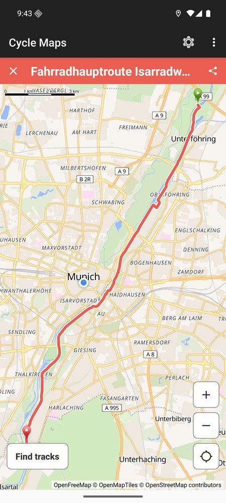
- 160,000+ routes and trails in OpenStreetMap
- 2.2 million stretches of cycleway mapped
- 30 city guides
- 18 countries
© OpenFreeMap © OpenMapTiles © OpenStreetMap
Find
A ride for wherever you are
Move the map to any place on Earth and see the routes and trails around it, each with its length, its climb and the shape of the ride. Going somewhere new? Look before you go.
- Routes by city, or around any spot you pick
- Length, climb and surface of a route
- Search by place, filter by distance and climb
Ride
Follow it on the road
See yourself on the route as you ride. Cycle Maps tells you when you drift off it and guides you turn by turn, even where there is no signal.
- Your position on the route, live
- Off-route alerts and voice guidance
- Offline maps for where coverage ends
Keep
Keep every ride
Record where you went, save the routes you love and send them to the people you ride with.
- Record a ride with one tap
- Favourites, always at hand
- Share a route as a link, or take it with you as GPX
Built on the map riders make
Routes and trails come from OpenStreetMap, the map kept by riders, walkers and mappers around the world. When the map gets better, so does Cycle Maps.
The tracks are cycling and mountain-bike tracks mapped in OpenStreetMap, found through Waymarked Trails. The counts of routes and cycleways are OpenStreetMap's, October 2026.
- A search lists at most 24, so where there are more, some are left out.
- Tracks longer than 150 km are not listed.
Your rides are yours
Your position is shown on the map and is used on your phone only. You decide what you share.
Questions
Where does it work?
Wherever routes are mapped in OpenStreetMap. Coverage follows the map: the more riders have mapped a place, the more you will find there.
Which phones does it work on?
Phones with Android 7.0 or later. There is no version for iPhone.
Can I see lengths in miles?
Yes. Choose metric or imperial units in Settings.
What happens with my location?
Your position is shown on the map and is used on your phone only. When you tap Find tracks, the app sends the middle of the map and the search radius to the Cycle Maps server, which answers with the tracks around that point. If the map is centred on you, that point is where you are.
Find your next great ride.